|
 |
 Автор: Williams Автор: Williams
 Дата: 18 мая 2023 Дата: 18 мая 2023
 Просмотров: 1 432 Просмотров: 1 432 |
| |
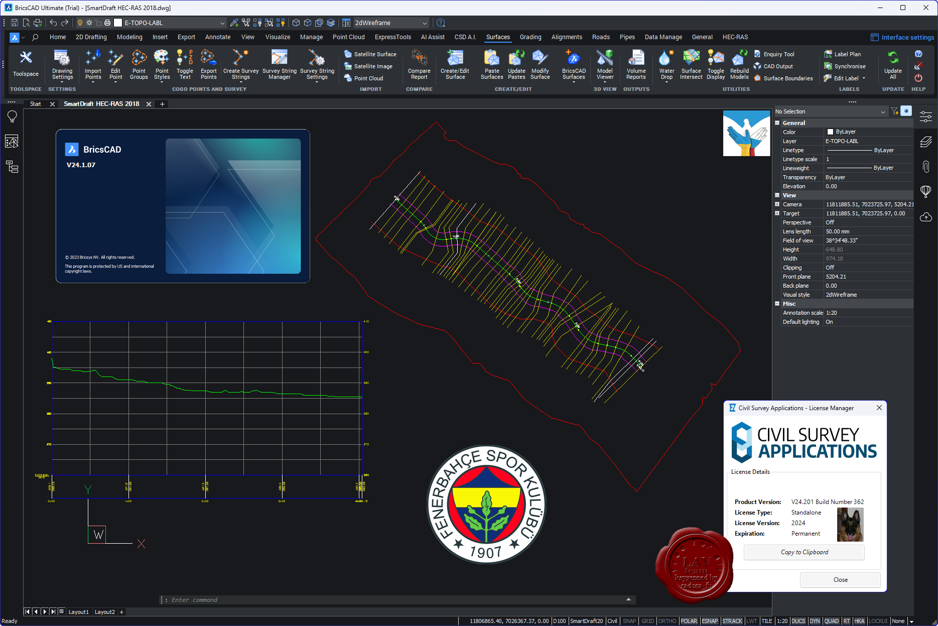
Civil Survey Applications (ex. Solutions) Stringer Topo v24.0 for Autodesk Civil 3D 2015-2024

Stringer Topo has been developed for the Australian surveying industry to facilitate the reduction and presentation of survey observations inside your drawing, whether you’re using AutoCAD, AutoCAD Civil 3D or BricsCAD. Developed by surveyors with over 20 years experience in the industry, Stringer focuses on maximizing your efficiency in adding and editing breaklines using point data directly in the drawing.
Stringer Topo delivers fast, easy to use field-to-finish topographical surveys, reducing your raw survey data to COGO points, automating the creation of 2D and 3D linework representing the point features, as well as adding breaklines to a TIN surface, all ready for final documentation and plotting. Associated functionality includes survey quality reporting, point export, import/export to numerous formats, traverse editing and drafting for cadastral plans.
- Stringer Topo works directly on COGO points and surfaces in the drawing to automate the breakline creation process and enable immediate updating of surfaces as points are edited.
- Stringer Topo provides you with all the tools you need to convert a raw observation file into an editable observation file, through to automated import of co-ordinated points. In AutoCAD Civil 3D, Stringer Topo works directly with the Civil 3D point objects. In other versions, Stringer Topo includes it’s own COGO point engine to provide user editable point display, point groups and point editing commands.
- Stringer Topo makes it quick and easy to add, edit and remove breaklines directly inside the drawing. With a wide collection of point and string editing tools you can quickly correct any pickup errors and get to the finished product. A survey Surface is automatically created and updated as Stringer Topo adds breaklines based on the point codes.
- Stringer Topo includes tools to import from other surveying programs so you can work with historical data.
|
| |
 Читать статью дальше (комментариев - 14)
| |
|
|
Автор: Williams
Дата: 17 мая 2023
Просмотров: 1 819 |
| |
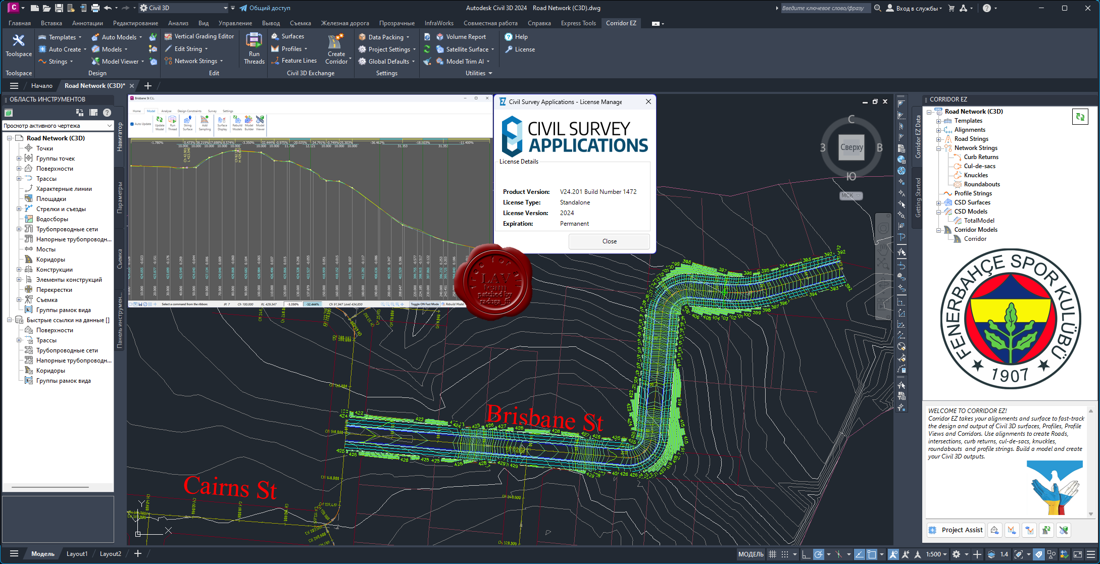
Civil Survey Applications (ex. Solutions) Civil Site Design v24.0 for Autodesk Civil 3D 2015-2024

For over 20 years CSS has assisted customers in the civil and survey industries with premium technical support, specialised and customised training services and development of industry driven software solutions built on Autodesk and other technologies. Civil Site Design (ex. Advanced Road Design) adds highly efficient and simple-to-use civil design tools for road network design, highways, road reconstruction, site grading, surfaces, stormwater, sewer and pipeline design to your current CAD platform.
|
| |
Читать статью дальше (комментариев - 23)
| |
|
|
Автор: Williams
Дата: 24 ноября 2021
Просмотров: 3 179 |
| |
Civil Survey Solutions Civil Site Design Plus Standalone v22.10

For over 18 years CSS has assisted customers in the civil and survey industries with premium technical support, specialised and customised training services and development of industry driven software solutions built on Autodesk and other technologies. Civil Site Design (ex. Advanced Road Design) adds highly efficient and simple-to-use civil design tools for road network design, highways, road reconstruction, site grading, surfaces, stormwater, sewer and pipeline design to your current CAD platform.
|
| |
Читать статью дальше (комментариев - 12)
| |
|
|
Автор: Williams
Дата: 22 ноября 2021
Просмотров: 2 493 |
| |
Civil Survey Solutions Civil Site Design v22.10 for Autodesk Civil3D 2015-2022

For over 18 years CSS has assisted customers in the civil and survey industries with premium technical support, specialised and customised training services and development of industry driven software solutions built on Autodesk and other technologies. Civil Site Design (ex. Advanced Road Design) adds highly efficient and simple-to-use civil design tools for road network design, highways, road reconstruction, site grading, surfaces, stormwater, sewer and pipeline design to your current CAD platform.
|
| |
Читать статью дальше (комментариев - 14)
| |
|
|
Автор: Williams
Дата: 30 марта 2021
Просмотров: 1 945 |
| |
Civil Survey Solutions Civil Site Design v21.31 for Autodesk Civil3D 2015-2021

For over 18 years CSS has assisted customers in the civil and survey industries with premium technical support, specialised and customised training services and development of industry driven software solutions built on Autodesk and other technologies. Civil Site Design (ex. Advanced Road Design) adds highly efficient and simple-to-use civil design tools for road network design, highways, road reconstruction, site grading, surfaces, stormwater, sewer and pipeline design to your current CAD platform.
|
| |
Читать статью дальше (комментариев - 9)
| |
|
|
Автор: Williams
Дата: 29 марта 2021
Просмотров: 2 340 |
| |
Civil Survey Solutions Civil Site Design Plus Standalone v21.30

For over 18 years CSS has assisted customers in the civil and survey industries with premium technical support, specialised and customised training services and development of industry driven software solutions built on Autodesk and other technologies. Civil Site Design (ex. Advanced Road Design) adds highly efficient and simple-to-use civil design tools for road network design, highways, road reconstruction, site grading, surfaces, stormwater, sewer and pipeline design to your current CAD platform.
|
| |
Читать статью дальше (комментариев - 7)
| |
|
|
Автор: Williams
Дата: 24 декабря 2020
Просмотров: 1 800 |
| |
Civil Survey Solutions Stringer Survey Suite v21.10 for Autodesk Civil 3D 2021 x64

Stringer Topo has been developed for the Australian surveying industry to facilitate the reduction and presentation of survey observations inside your drawing, whether you’re using AutoCAD, AutoCAD Civil 3D or BricsCAD. Developed by surveyors with over 20 years experience in the industry, Stringer focuses on maximizing your efficiency in adding and editing breaklines using point data directly in the drawing.
Stringer Topo delivers fast, easy to use field-to-finish topographical surveys, reducing your raw survey data to COGO points, automating the creation of 2D and 3D linework representing the point features, as well as adding breaklines to a TIN surface, all ready for final documentation and plotting. Associated functionality includes survey quality reporting, point export, import/export to numerous formats, traverse editing and drafting for cadastral plans.
- Stringer Topo works directly on COGO points and surfaces in the drawing to automate the breakline creation process and enable immediate updating of surfaces as points are edited.
- Stringer Topo provides you with all the tools you need to convert a raw observation file into an editable observation file, through to automated import of co-ordinated points. In AutoCAD Civil 3D, Stringer Topo works directly with the Civil 3D point objects. In other versions, Stringer Topo includes it’s own COGO point engine to provide user editable point display, point groups and point editing commands.
- Stringer Topo makes it quick and easy to add, edit and remove breaklines directly inside the drawing. With a wide collection of point and string editing tools you can quickly correct any pickup errors and get to the finished product. A survey Surface is automatically created and updated as Stringer Topo adds breaklines based on the point codes.
- Stringer Topo includes tools to import from other surveying programs so you can work with historical data.
|
| |
Читать статью дальше (комментариев - 11)
| |
|
|
| ПОИСК ПО САЙТУ |
|
|
|
|