|
 |
 Автор: Williams Автор: Williams
 Дата: 22 апреля 2013 Дата: 22 апреля 2013
 Просмотров: 1 872 Просмотров: 1 872 |
| |
Integrated Engineering Software Visual Foundation v4.0.3.0
IES, Inc. creates high quality structural design software for engineering and related professionals. Your solution for general analysis, frames, trusses, shear wall systems, foundations, retaining walls, floor systems and more in steel, wood, concrete, aluminum, cold-formed, and masonry.
Why use VisualFoundation? You have choices in the marketplace, for mat footings -even among IES tools! VisualFoundation shines in a number of areas:
- Dedicated to foundations, so easier to use than VisualAnalysis for this task.
- Automated modeling - the FEA model is built and refined automatically.
- Incorporate the effects of walls and beams in the slab.
- Over 2500 companies use IES tools: one part-time support person at IES!
Major Benefits and Abilities:
- Mat foundation analysis and design.
- Complex mat boundaries, including circular and polygonal templates.
- Generate copies of modeling elements using rectangular or circular patterns.
- Multiple mat thicknesses or soil properties.
- Holes in mats.
- Combined footings.
- Wall footings.
- Walls, grade beams, columns and pile supports.
- Unlimited model size.
- Support for codes: IBC, ASCE 7, ACI 318.
- Automated FEA meshing and soil-spring supports.
- Sophisticated thick-plate finite element formulation.
- Import & Export DXF files.
- Import & Export with VisualAnalysis.
- New! Improved usability: easy graphics and toolbar commands.
More info. |
| |
 Читать статью дальше (комментариев - 6)
| |
|
|
Автор: Williams
Дата: 21 апреля 2013
Просмотров: 1 559 |
| |
Integrated Engineering Software Quick Footing v2.0
IIES, Inc. creates high quality structural design software for engineering and related professionals. Your solution for general analysis, frames, trusses, shear wall systems, foundations, retaining walls, floor systems and more in steel, wood, concrete, aluminum, cold-formed, and masonry.
Concrete spread footing (single column pad), imports from VisualAnalysis. Design and check reinforced concrete footings under a single column without building a complex analysis model of the building.
Key benefits:
- Will check several footings all at once (for worst case).
- Automatic sizing and detailing (optional).
- Advanced handling of biaxial loading.
- Offset pedestal from footing center.
- Checks footing, pedestal, and interface.
- Stability checks: Bearing pressure (net & gross), overturning, sliding, and uplift.
- Complete units flexibility.
- Accurate calculation of bearing pressure under biaxial loading.
Gets you out of the black box with Transparent Reporting. The software presents hyperlinks from every check to the complete check details including full algebraic expression of the code formula, substituted values, intermediate results, final results, and "OK" or not! This checking and verification output is available on-screen and in a detailed report. The software does the work, but you can check it every step of the way, and so can your checkers, the building-department people, or anyone else who needs to know.
More info. |
| |
Читать статью дальше (комментариев - 11)
| |
|
|
Автор: Williams
Дата: 20 апреля 2013
Просмотров: 1 358 |
| |
Integrated Engineering Software Quick Masonry v3.00.00009
 IES, Inc. creates high quality structural design software for engineering and related professionals. Your solution for general analysis, frames, trusses, shear wall systems, foundations, retaining walls, floor systems and more in steel, wood, concrete, aluminum, cold-formed, and masonry.
A stand alone tool of masonry components to manage multiple structural components within a single project file. The QuickMasonry "Project Management" tool offers the ability to design a whole series of lintels and walls, for a single building in one project file, following the latest masonry design specifications and offering a host of impressive features.
Quick Masonry has been specially designed to display every calculation performed along with any associated diagrams. This complete exposure of calculations is unmatched in the industry and allows the peace of mind that comes from personally viewing and verifying any calculation about which there may be a question.
Masonry Components Handled:
- Lintels & Beams
- Bearing Walls
- Panel Walls (loads out of plane)
- Shear Walls
- Columns and Pilasters
Design Specifications:
- MSJC-2008 or MSJC-05 Code Provisions (ACI 530, ASCE 5, TMS 402, ASCE 6, TMS 602)
- Strength Design Provisions
- ASD (Allowable Stress Design) both MSJC-2008 and MSJC-05, reinforced & unreinforced
More info. |
| |
Читать статью дальше (комментариев - 11)
| |
|
|
Автор: Williams
Дата: 19 апреля 2013
Просмотров: 3 229 |
| |
Gemcom Surpac v6.4.1 x86
Gemcom Surpac является ведущей программой для геологоразведочных и горнодобывающих предприятий. Графический интерфейс разработан на языке Java. Используя передовую структуру обработки информации, Gemcom Surpac дает возможность работать с данными других программных продуктов и объектами, созданными при помощи большинства горно-геологических и геоинформационных программ.
Геологический модуль
Основой геологического модуля является база данных по разведочным выработкам. Геологический модуль предоставляет пользователю следующие возможности:
- ввод данных из журналов разведочного бурения;
- редактирование геологических данных по скважинам, пополнение базы данных результатами лабораторных анализов;
- интеграция данных по скважинам с графическими построениями;
- манипуляция с данными по геологоразведочным скважинам (простые и сложные пересчеты, композирование данных и т.д.);
- обработка данных методом классического статистического анализа геологоразведочной информации (по данным опробования) с выводом на печать графиков гистограмм, таблиц и результатов их анализа;
- полный геостатистический анализ любых трехмерных данных, включая расчет и моделирование вариограмм, карт вариаций изменчивости и оценку пространственной анизотропии минерализации;
- подсчет запасов различными методами (методом геологических разрезов в пределах объемных моделей, с использование блочных моделей, и т.д.);
- редактирование и модернизация графической и математической геологической модели.
Модуль обработки маркшейдерских данных и БВР
Данный модуль предоставляет пользователю следующие возможности:
- обработка данных ручной маркшейдерской съемки (теодолитный ход и др.);
- ввод и обработка данных цифровых маркшейдерских приборов;
- построение фактических контуров отработки по данным маркшейдерских съемок;
- генерация производственных отчетов;
- визуализация горных работ, выдача графической документации;
- проектирование сетей взрывных скважин, включая оконтуривающие наклонные скважины, автонумерация скважин, загрузка их в базу данных.
Объемное и блочное моделирование
Данный модуль предоставляет пользователю следующие возможности:
- возможность построения триангуляционных моделей любых объектов и поверхностей;
- наличие развитых инструментов создания параллельных сечений и пересекающихся полилиний в каркасных моделях, а также инструментов редактирования (сложение, вычитание, пересечение, изменение триангуляционной сети);
- построение и модернизация блочных моделей с заданным размером элементарных блоков и интерполяций содержаний в элементарных блоках моделей.
Модуль оптимизации и планирования
Данный модуль предоставляет пользователю следующие возможности:
- возможность разработки перспективного плана ведения открытых горных работ, создания отчетных документов;
- возможность решения задач оптимизации конечных контуров карьера, этапов его отработки и календарного плана горного предприятия;
- возможность детального проектирования карьера;
- возможность разработки и корректировки оперативного плана ведения открытых горных работ с использованием имитационного моделирования работы транспортно-погрузочных комплексов;
- визуализация плана горных работ, выдача графической документации;
- интеграция модуля планирования горных работ с модулями обслуживания горного оборудования, материально-технического снабжения, финансовым модулем;
- возможность создания и поддержки сетки технологических (пользовательских) координат.
|
| |
Читать статью дальше (комментариев - 9)
| |
|
|
Автор: Williams
Дата: 18 апреля 2013
Просмотров: 2 820 |
| |
Deswik v2.0.3936
 Deswik Mining Consultants is an international company offering innovative mining engineering and geology services. We also produce cutting edge mine planning software by merging technical mining domain skills from each sector, with specialist programming expertise and the latest software development technologies. Our consulting acts as R&D for our software, and our software gives our consultants and clients a competitive edge. The company was formed in 2008, by the founders of African Computer Mining Services Pty Ltd (ACMS) who originally developed the popular Mine2-4D mine planning software. Deswik was also involved in minerals processing, however this part of the business has since been sold. Though Deswik is a relatively young company, our heritage of almost 20 years of delivering mine planning software solutions means that we have come a long way in a short period of time ... and we've only just begun. Our culture of high performance and innovation will ensure we remain a formidable force in the industry for a long time to come.
Deswik.CAD has been designed by mining engineers with decades of professional software development experience and a proven history of building technical mining applications. Programmed in the latest technologies to take advantage of high performance and cutting-edge computing developments, Deswik.CAD provides the user with a simple, modern and intuitive CAD-style interface. Deswik.CAD is effectively a spatial database combining the power of CAD with the ability to attribute, filter and report data visually and in tabular format. The file format is XML, so all data is open and transferable to other systems. Deswik.CAD is used across all mining sectors and is used in underground and open pit mines, both coal and metal, throughout the world. A list of all available modules and their functionality is outlined below.
Deswik.Scheduler. From interactive Gantt charts to PERT network diagrams, Deswik Scheduler is tailored for the needs of open pit or underground mine planners and can handle massive data sets while remaining responsive. For project managers, Deswik Scheduler provides Work Breakdown Structures and detailed Critical and Point to Point path analysis. Create detailed shift calendars for long term down to shift by shift scheduling or import your time usage model. Deswik Scheduler directly integrates with Deswik.CAD and the Deswik Interactive Scheduler to allow simple updating of mining task information from the graphics. Deswik Scheduler can import and import schedules from most of the popular scheduling packages including Microsoft Project, Primavera, and EPS.
The Deswik Landform and Haulage solution has the power, flexibility and ease of use to enable all engineers to answer questions which have hitherto been very difficult to answer. How many trucks do I require? What is the best truck to apply to my mining geometry? Is in-pit crushing and conveying more economical than a traditional truck haul? How does my fixed fleet affect my mining schedule and shovel productivities? What is the incremental value of adding a truck to my current fleet? Traditionally haulage has been performed by taking centroids from mining and dumping locations and manually calculating cycle times. Due to the manual nature of the process, only a handful cycletimes are practically possible and larger data sets are consequently used. Deswik has found that this can result in up to a 20% margin of error and, in addition, few options can be explored which leads to sub-optimal planning outcomes. The Deswik Landform and Haulage solution has the power, flexibility and ease of use to enable all engineers to answer questions which have hitherto been very difficult to answer. How many trucks do I require? |
| |
Читать статью дальше (комментариев - 7)
| |
|
|
Автор: Williams
Дата: 17 апреля 2013
Просмотров: 2 308 |
| |
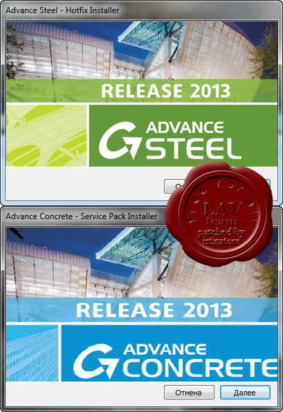
Advance Steel Hotfix 1
Advance Concrete Hotfix 1
for Graitec Advance Suite 2013
Еще раз, это - пакеты обновлений. С лекарством. Новым. Специально для хотфикс 1.
Сам же GAS 2013 можно скачать тут. |
| |
Читать статью дальше (комментариев - 12)
| |
|
|
Автор: Williams
Дата: 16 апреля 2013
Просмотров: 2 461 |
| |
Piping Systems FluidFlow v3.23
FluidFlow - ПО для полноценного проектирования гидравлических систем. Размерность решаемых в FluidFlow задач варьируется от одной трубы до большой комплексной системы трубопроводов как с разветвленными, так и с замкнутыми участками, включающими насосное, емкостное и прочее гидравлическое оборудование. FluidFlow работает и с жидкими, и с газовыми средами.
FluidFlow является интерактивной системой - используемые алгоритмы способны динамически (в реальном времени) осуществлять расчеты и отображать результаты по мере ввода исходных данных. Интерактивность позволяет применять FluidFlow для симуляции (моделирования) работы действующей или реконструируемой гидравлической системы - возможные проблемы выявляются в реальном времени и могут быть легко устранены.
Система снабжена дружественным интерфейсом ввода и представления данных: в распоряжении пользователя - и возможности одновременного просмотра данных и схемы, и интерактивные функции редактирования (перетаскивание, пролистывание, зумирование, отмена операции), и инструменты копирования через буфер, а также другие функции Windows-интерфейса, которые позволяют задать расчетную схему с минимальными затратами времени и максимальной гибкостью.
Взаимное соответствие и целостность данных проверяются в непрерывном режиме - таким образом, проверка осуществляется при вводе исходных данных, а результаты и оповещение об ошибках вы получаете немедленно. Единое хранение расчетной и визуальной моделей делает возможным анализ системы в целом, без ее разбивки на фрагменты. |
| |
Читать статью дальше (комментариев - 25)
| |
|
|
Автор: Williams
Дата: 14 апреля 2013
Просмотров: 6 585 |
| |
Data East XTools Pro v9.2.1006 english russian for ArcGIS Desktop up to v10.1
XTools Pro – уникальный набор полезных инструментов для пространственного анализа, конвертации объектов и работы с атрибутивными таблицами в ArcGIS, существенно расширяющих стандартный функционал системы ArcGIS. XTools Pro 8.2 включает в себя более сотни инструментов для проведения различных преобразований и анализа векторных и табличных данных, а также геообработки.
Подробнее тут. |
| |
Читать статью дальше (комментариев - 43)
| |
|
|
| ПОИСК ПО САЙТУ |
|
|
|
|